

Most of my childhood family vacations involved traveling by car, where I would “help” by perusing the road atlas during our trip. I love a good map, and if it’s an historic map, so much the better. I was happier than the proverbial pig when I discovered the county’s online map resources, which include an aerial archive that lets you view maps at various points over the past hundred years. I located Willow Greens Farm and began my journey back in time to 2002, 1957, 1937, and finally, 1853.
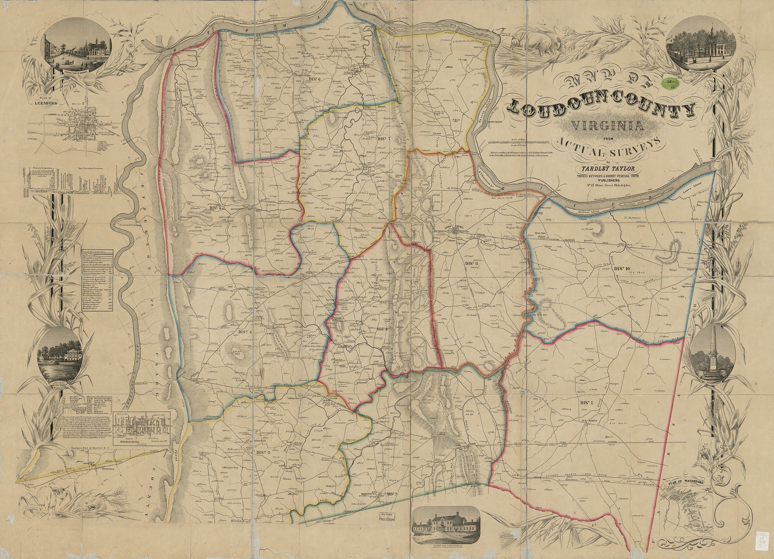
The 1853 map is famous in these parts as the first-ever map of Loudoun County. It was incredibly detailed, noting the owners of land and water-powered mills, and the denominations of all places of worship. And then I found, exactly where they should be, two adjacent plots labeled “T Taylor” and “C Taylor,” both sons of Timothy Taylor, the founder of Willow Greens Farm.
Even though I knew the property remained in the family many years after Timothy’s death, it was really exciting to find documented evidence. Even more exciting was the discovery that the map itself has a Taylor family connection. The first map of Loudoun County was created by none other than Timothy Taylor’s nephew:

Yardley Taylor was an arborist with his own horticultural business. He was also a surveyor and mail carrier. A Quaker, Yardley was a passionate abolitionist, serving as President of the Manumission and Emigration Society of Loudoun in 1824, along with his brother Henry. He organized conventions and raised money to free slaves and resettle them in non-slave states or repatriate them to Liberia. Yardley and other Quakers supported the Union cause during the Civil War. When he died in 1868, he was buried in Goose Creek Burying Ground, where his uncle Timothy and other family members also rest.
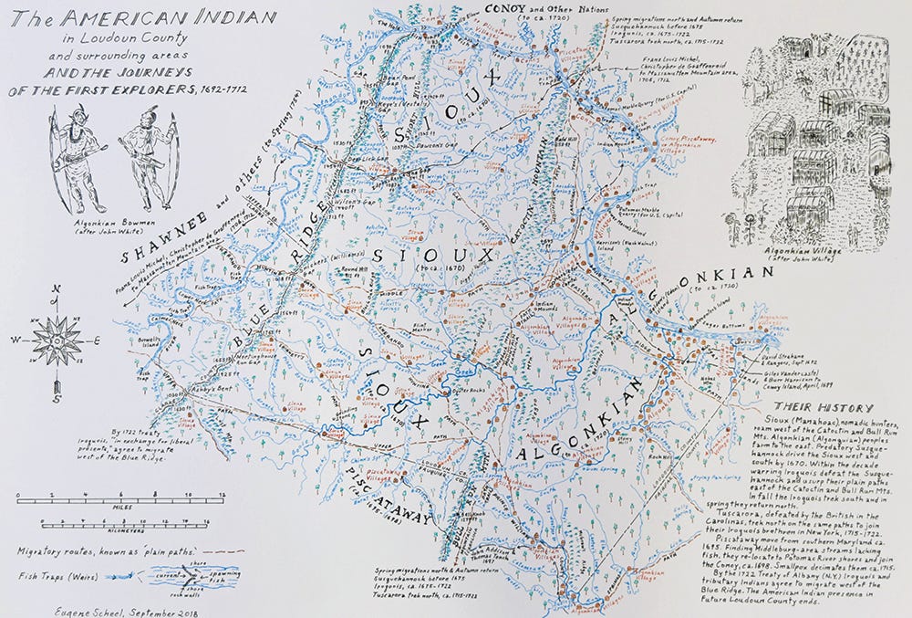
The art of mapmaking is still going strong in Loudoun County, thanks to historian Eugene Scheel. Like Yardley Taylor, Scheel creates his maps by hand in exacting detail. He has traveled all over Virginia, mapping its counties through the lens of history. His work includes maps of the Civil War period, and an American Indian map depicting settlements, travel ways, and the areas where tribes once lived. This last one is quite fascinating, so I’ll close by giving you a peek at it here. You can read more about Eugene in The Piedmont Virginian’s 2021 article, Mapping History with Eugene Scheel.
Your house and its connections just get more and more fascinating. I too love maps, so think it's splendid that you have found such an early one covering your homestead. I wonder if it's possible to get a copy and have it framed for your place? Was Willow Greens Farm on the underground railroad--if you've said, I've forgotten.
This is fascinating!